Pueblo Bonito in Astrology and Astrogeography. The construction site of Pueblo Bonito in New Mexico in the combination of Capricorn with Capricorn
Related articles: Capricorn in Astrogeography, Acoma Pubelo: Scorpio with Aries as the constellation of strongholds, Checkerboard Mesa & Angels` Landing in Scorpio with Gemini, The Sedona Vortex System in astrogeography, Aquarius as the corresponding sign of Maya culture,
The construction sites of important places of Native American History in Astrogeography
Pueblo Bonito in Double Capricorn
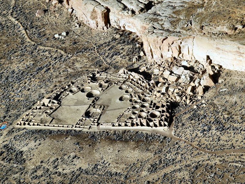
ph Bob Adams, Albuquerque,,ccbysa3.0
Pueblo Bonito is the name of a village in Chaco Canyon, a part of the holy land of the Ancient Pueblo People in New Mexico, USA built and inhabited between 850-1150 AD. It represents an important part of the U.S. – American cultural history and at least up to 18th Century it was the largest building in the United States.
The two largest round structures of Pueblo Bonito called the great “Kivas” are ceremonial meeting rooms precisely aligned in a north-south direction. Pueblo Bonito appears to have been an important temple site and probably a site of tribal administration and gatherings. At the time of the foundation of the village the area was covered with pine forest, so that the village can be seen as an early example of the consequences of deforestation. After 300 years it was deserted by the pueblo people probably due to water scarcity.
Astrogeographic position for morphogenetic field level 3 which describes the atmosphere and energetical topics of the construction site and how the area is embedded in the land: both astrogeographical coordinates of the of the site are located in solid, defensive, strict, conservative earth sign Capricorn the sign of mountains, rocks, stability, traditions, control, central government institutions, administration, rules and regulations. Capricorn indicates that the pueblo had the function of an administrative center built to stabilize, control and preserve the tribal organisation and hierarchy and the rule of a single dynasty or group. As the sign of governments Capricorn reflects the potential function of Pueblo Bonito as a central gathering place for decisions on tribal laws, politcs and justice. In regard to the function as a temple and place for important worship and sacrificial rites Capricorn stands for a central temple dedicated to annual fertility rites or rites dedicated to securing food supply and the defense and stability of the tribal organisation.
For this aspect of Capricorn compare typical examples for important central sites of state religion located in Capricorn: Göbekli Tepe. Machu Picchu, Bighorn Medicine Wheel, Tian Tan Temple in Beijing, Karnak Temple, Pashupatinath Temple. Washington National Cathedral, The Temple of Zeus in Olympia, The Temple of the Eleusinian Mysteries, Meenakshi Aman Temple, St. Peter`s Basilica in Rome, Icelandic native religion headquarters in Capricorn,
Although the building appears not to have been built as a fortress in the first place, the position in Capricorn indicates that the character of the complex is one of a central building and government area for the tribe with a defensive character. The double constellation of Capricorn, the opposite of water sign Cancer the natural ruling principle of freshwater springs could be an indication that the place was abandoned due to water shortage.
Chetro Ketl
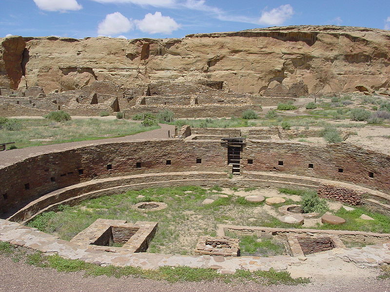
Chetro Ketl located 600 m east of Pueblo Bonito lies in the same astrogeographical combination for morphogenetic field level 3: Capricorn -Capricorn.
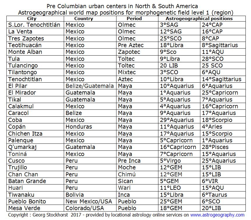
Pre Columbian urban centers in North & South America in astrogeography
Navajo National Monument
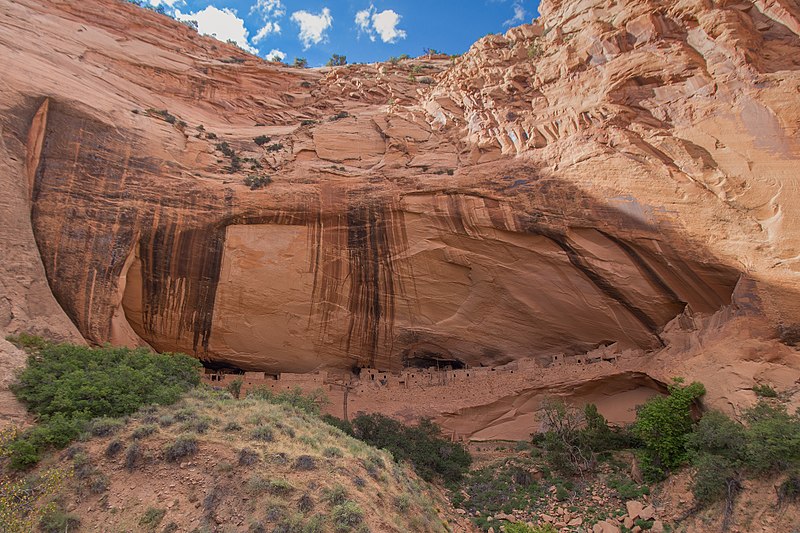
Keet Seel Cliff Dwellings
Keet Seel is a well preserved cliff dwelling of the ancient Anasazi (ancestral puebloans) people in a branch of Tsegi Canyon. The site was first occupied at around 1250. There was a construction boom at Keet Seel between 1272 and 1275 until it seems to have stopped in 1286. The site was abandonment some 20 years later. Up to 150 people inhabited this site at one time.
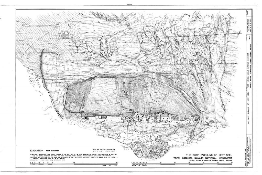
Astrogeographical resonance coordinates of the Keet Seel village for morphogenetic field level 3 which describes the whole of the larger area of the village: one coordinate is located in careful, self-protective earth sign Virgo the sign of optimal use of natural ressources, reason, health, storing goods, protected places and strategical planning. The 2nd coordinate is in creative, innovative air sign Aquarius sign of the sky, heaven, paradise, self-finding, ideals, socialism and an indication for t new developments and inventions. As the sign of skyscrapers Aquarius stands for the elevated position of the caves.
Mesa Verde
Mesa Verde National Park is an American national park and UNESCO World Heritage Site located in Montezuma County, Colorado. The park protects some of the best-preserved Ancestral Puebloan archaeological sites in the United States.
The Cliff Palace at Mesa Verde
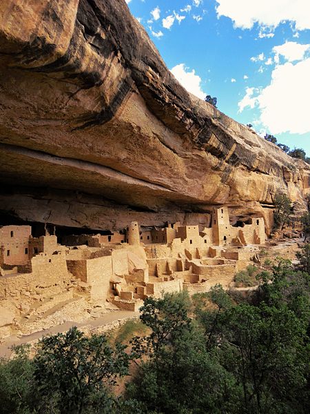
ph: Rationalobserver , ccbysa4.0
Astrogeographical position of the Cliff Palace at Mesa Verde for morphogenetic field level 4 which describes the energetical topics and atmosphere of the buildings: the site stretches form highly magnetic, royal fire sign Leo (north half) sign of the sun, light, heart, kings, palaces, luxury, energetical centers into self-protective earth sign Virgo (south half) the sign of optimal use of natural ressources, reason, health, storing goods, protected places and strategical planning. The 2nd coordinate is located in mystic spiritual water sign Pisces sign of dreaming, hiding, temples, legends, letting go,
The Sun Temple at Mesa Verde – a calendar building
The Mesa Verde people seem to have used astronomical observations to plan their farming and religious ceremonies, drawing on both natural features in the landscape and masonry structures built for this purpose. Some of their houses were aligned to the cardinal directionswith windows, doors and walls along the path of the sun, whose rays would indicate the passing of seasons.
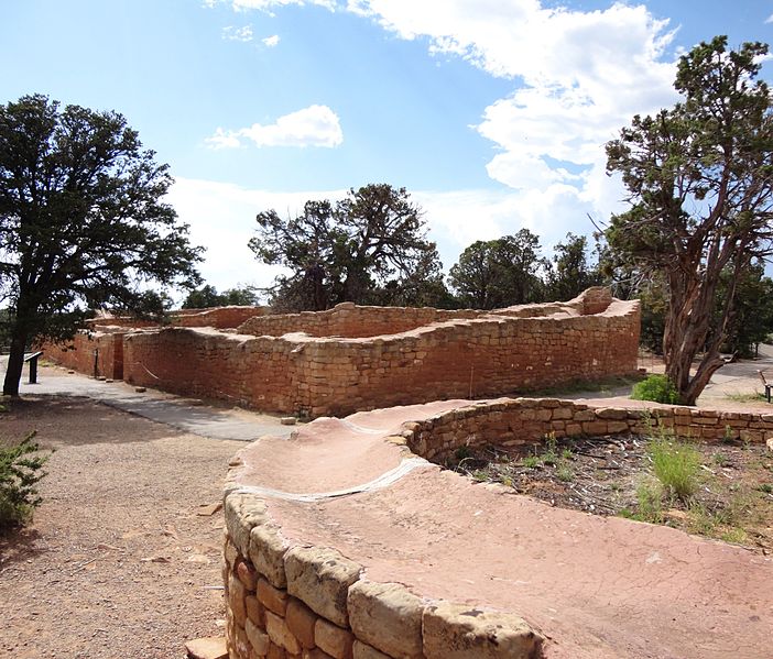
The temple is D-shaped and Its location and orientation indicate that its builders understood the cycles of both the sun and the moon. It is aligned to the major lunar standstill, which occurs once every 18.6 years, and the sunset during the winter solstice, which can be viewed setting over the temple from a platform at the south end of Cliff Palace. At the bottom of the canyon is the Sun Temple fire pit, which is illuminated by the first rays of the rising sun during the winter solstice. Sun Temple is one of the largest exclusively ceremonial structures ever built by the Ancestral Puebloans
Astrogeographical position of the Mesa Verde Sun Temple and observatory for morphogenetic field level 4 (exact position) which describes the energetical topics of the structure itself: one coordinate is located in creative, innovative air sign Aquarius sign of the sky, heaven, paradise, self-finding, stars, outer space, flying and indicator for the function as a sky temple and star observatory. 2nd coordinate is in solid fixed water sign Scorpio sign of sculpting, fortresses, alchemy, perception, visualization.
